· Borders & Frontiers · 3 min read ·
Maritsa River: The Contested Borderline Dividing Three Balkan Nations
Winding 480 kilometers from glacial alpine lakes to the Aegean Sea, the Maritsa serves as an unnavigable liquid frontier between Bulgaria, Greece, and Turkey.
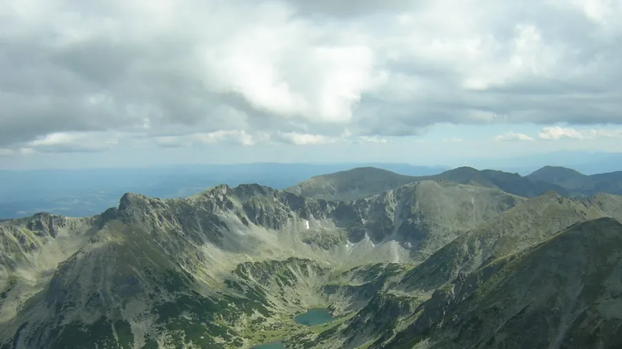
Alpine origins in the Rila mountains
The Maritsa River begins at an elevation above 2,300 meters in the Rila Mountains of western Bulgaria. Its headwaters emerge from the glacial Marichini Lakes, pooling beneath towering granite peaks before cutting a steep descent eastward. Flowing across 480 kilometers, it stands as the longest waterway contained solely within the interior of the Balkan Peninsula.
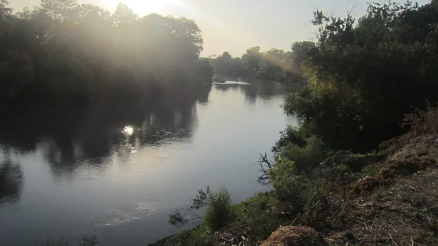
As the river leaves the highlands, it carves a broad valley between the Balkan range to the north and the Rhodope Mountains to the south. This natural corridor has served as the primary east-west overland route across southern Bulgaria for millennia. The river flows through key industrial and historic centers, including Plovdiv and Dimitrovgrad, carrying high volumes of mountain runoff into the lowland basin.
 Figure 1: The upper Maritsa cutting through the southern Bulgarian basin near Harmanli.
Hydrology and regional irrigation
The drainage basin of the Maritsa covers roughly 53,000 square kilometers, anchoring the historic territory of Thrace. Bulgaria holds the largest share of this catchment area at 66.2 percent, followed by Turkey at 27.5 percent and Greece at 6.3 percent. Despite ranking among the largest rivers in Europe by volume of discharge, the river remains completely unnavigable for commercial vessels due to variable seasonal depths, shallow gravel banks, and rapid currents.
Because navigation is impossible, riparian states have redirected the watercourse for practical production. In Bulgaria, reservoirs and dams capture torrential spring surges to generate hydroelectric power. Downstream, extensive canal networks divert river discharge to irrigate agricultural fields, sustaining cereal, sunflower, and tobacco crops across the semi-arid Thracian plains.
 Figure 2: The widening riverbed approaching the confluence at Edirne.
The confluence at Edirne
Near the border town of Svilengrad, the river begins to trace international frontiers. East of the town, the north bank lies in Bulgaria while the south bank enters Greece. The channel then moves eastward toward Edirne, historical Adrianople, where it meets its two largest tributaries: the Tundzha from the north and the Arda from the west.
At Edirne, the combined waterways flow through Turkish territory on both riverbanks. This tripoint zone gathers runoff from across the entire Balkan interior, creating a powerful single channel that turns southward toward the Mediterranean basin. Here, the river changes name according to local administration, recognized officially as the Meriç in Turkey and the Evros in Greece.
 Figure 3: Extensive seasonal flooding along the Greek bank of the lower border corridor.
The modern river border and Aegean delta
South of Edirne, the watercourse forms the permanent frontier between Greece along the western bank and Turkey along the eastern bank. The riverbed is prone to dynamic shifts, creating shifting islands, mudflats, and seasonal backwaters that challenge fixed border markers. Severe winter floods regularly submerge agricultural land around villages like Lavara, turning the border zone into an impassable marshland.
The lower course terminates at the Aegean Sea near the ancient coastal settlement of Enez. At this river mouth, sediment deposition has created a sprawling delta of brackish lagoons, salt marshes, and sand spits. The delta serves as a critical biological refuge for migratory waterfowl while marking the sovereign boundary where the land border transitions into maritime waters.
 Figure 4: Regional catchment map showing the 53,000-square-kilometer Thracian watershed.