· Geographic Paradoxes · 5 min read ·
Kuala Lumpur: The Tin Mining Outpost Turned Megacity Enclave
Enclaved within Selangor, Kuala Lumpur transformed from a nineteenth-century tin outpost into an autonomous federal enclave anchoring Southeast Asian commerce.
Kuala Lumpur began in 1857 as a muddy settlement established to support prospecting operations in the tin-rich interior of the Malay Peninsula. Prospectors sailed up the Klang River until they reached its confluence with the Gombak River, establishing an inland depot that became known as “muddy confluence” or Kuala Lumpur. Disease and fires repeatedly threatened the outpost during its early decades, yet rich mineral deposits drew thousands of migrant laborers, primarily Chinese miners and Malay merchants. Local headman Yap Ah Loy served as Kapitan Cina during the Selangor Civil War, rebuilding the settlement after devastating destruction in the 1870s and instituting civic administration.
British colonial resident Frank Swettenham recognized the commercial value of the location and designated the town as the administrative capital of Selangor in 1880, relocating government operations from coastal Klang. Swettenham directed the reconstruction of municipal infrastructure, requiring brick and tile construction after a fire and subsequent flood destroyed the thatched wooden town in 1881. In 1896, the British colonial authorities unified Perak, Selangor, Negeri Sembilan, and Pahang into the Federated Malay States, designating Kuala Lumpur as the federal seat. The colonial government laid rail connections to coastal ports, positioning the town at the intersection of British Malaya’s raw export trade.
 Figure 1: High-rise towers dominate the skyline of Kuala Lumpur’s central business district, viewed from the World Trade Centre.
Administrative evolution and federal separation
The city remained the political anchor through Malaya’s path to sovereignty. Following independence in 1957, Kuala Lumpur became the federal capital of the Federation of Malaya, and subsequently of Malaysia upon its formation in 1963. A critical constitutional shift occurred on February 1, 1974, when the federal government and the State of Selangor signed an agreement severing the city from the surrounding state. Selangor ceded 243 square kilometers of territory to establish the Federal Territory of Kuala Lumpur, ensuring that the federal capital operated under national jurisdiction rather than state governance.
Selangor relocated its state capital to Shah Alam in 1978. In 1999, facing severe municipal congestion and administrative bottlenecks, the federal government moved its executive and judicial branches 25 kilometers south to the newly developed planned city of Putrajaya. Despite this administrative dispersion, Kuala Lumpur retained its constitutional designation as the national capital. The Malaysian Parliament, consisting of the Dewan Rakyat and the Dewan Negara, continues to sit in Kuala Lumpur, alongside Istana Negara, the official residence of the Yang di-Pertuan Agong.
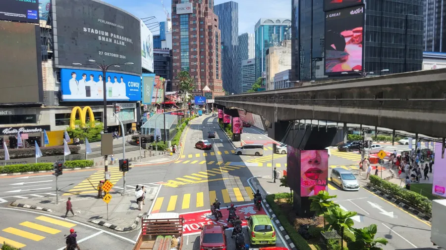
 Figure 2: An elevated KL Monorail train departs Raja Chulan station, traversing the commercial corridor of Bukit Bintang.
Demographics and the Klang Valley conurbation
Geographically enclaved entirely within the borders of Selangor on the central west coast of Peninsular Malaysia, the federal territory covers 243 square kilometers. Within these official boundaries, the resident population reached 2,111,536 by 2026. However, municipal borders reflect only a fraction of the actual metropolitan footprint. The contiguous urbanized zone known as Greater Kuala Lumpur or the Klang Valley incorporates major peripheral cities including Petaling Jaya, Subang Jaya, Shah Alam, and Klang, forming a combined conurbation of 8.81 million residents.
This urban corridor represents one of the fastest growing metropolitan regions in Southeast Asia. Economic development across the valley centers on services, finance, retail trade, and technological infrastructure. The city center houses three of the ten largest retail shopping malls in the world and draws tens of millions of international travelers annually. Major corporate headquarters occupy commercial precincts throughout the city, anchored visually by the 452-meter Petronas Towers, which held the title of the world’s tallest buildings from 1998 to 2004 and remain the tallest twin buildings on earth.
 Figure 3: Modern rolling stock at Lembah Subang depot operates on the Kelana Jaya line across the Klang Valley transit grid.
Transit infrastructure and economic primacy
Managing the expansion of the Klang Valley required an extensive overhaul of transportation systems. Beginning in the 1990s, municipal and federal agencies constructed the Klang Valley Integrated Transit System, combining heavy rail commuter lines, light rail transit, elevated monorails, and mass rapid transit corridors. Central transit operations converge at Kuala Lumpur Sentral, a multimodal interchange providing direct express rail connections to Kuala Lumpur International Airport in Sepang as well as intercity lines across Peninsular Malaysia.
The modern economy of the capital balances domestic industrial output with multinational trade. Local manufacturing sectors, including domestic automobile production, operate in tandem with global financial services. International assessments reflect this status: the city placed 70th globally and second in Southeast Asia behind Singapore in the Economist Intelligence Unit’s Global Liveability Ranking, and 79th globally in the Oxford Economic Papers’ Global Cities Index in 2025. Through rapid urbanization and structural decentralization, Kuala Lumpur remains the commercial and cultural core of modern Malaysia.
 Figure 4: A Proton Persona taxi parked along a street in Kuala Lumpur, reflecting national domestic automotive manufacturing.