· Natural Wonders · 4 min read ·
Ares Vallis: The Cataclysmic Outflow Channel of Ancient Mars
Carved by colossal catastrophic floods, this vast Martian channel stretches across thousands of kilometers to empty into the lowlands of Chryse Planitia.
Across the rust-colored highlands of Mars, vast canyons cut through cratered crust with dimensions that dwarf any river system on Earth. Among these geological features, Ares Vallis stands as one of the largest outflow channels ever identified in planetary science. Beginning in a collapsed depression known as Iani Chaos and running northwest for more than two thousand kilometers, the channel gouged its way through the ancient plateaus of Margaritifer Terra and Xanthe Terra before spilling into the low-lying plains of Chryse Planitia.
The sheer volume of rock and sediment transported through Ares Vallis indicates water discharges beyond anything recorded in human history. Planetary geologists estimate that peak flow rates exceeded tens of millions of cubic meters per second. These catastrophic floods stripped the ground down to bedrock, leaving behind monumental streamlined islands shaped like aerodynamic water drops pointing downstream in the direction of the surging torrent.
 Figure 1: Perspective rendering of Ares Vallis captured by ESA Mars Express, displaying streamlined teardrop islands carved by cataclysmic floods.
The collapse of Iani Chaos and volcanic triggering
The origin of the water that shaped Ares Vallis lies in the chaotic terrain to the south. In regions like Iani Chaos, the surface collapsed into broken blocks and fractured mesas measuring hundreds of kilometers across. Beneath this ground lay massive reserves of subsurface ice and pressurized groundwater. During the Hesperian period roughly three billion years ago, intense regional volcanism and geothermal heating destabilized these underground aquifers.
When the subsurface ice melted under pressure, the ground above lost structural support and fell inward. Water erupted onto the Martian surface in colossal geysers and flash floods, tearing into the surrounding terrain and opening the southern entrance of Ares Vallis. High-resolution imagery from orbital missions reveals that interconnected lake systems formed across the equatorial highlands. As each basin reached maximum capacity, the water breached surrounding rims, carving channels into lower depressions in violent succession.
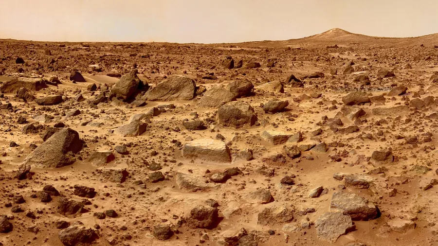
 Figure 2: NASA Mars Pathfinder and the Sojourner rover analyzing volcanic boulders across the Ares Vallis outwash plain in 1997.
The historic touchdown of Mars Pathfinder
The depositional fan where Ares Vallis merges into Chryse Planitia presented an ideal geological destination for robotic exploration. On 4 July 1997, NASA Mars Pathfinder deployed its lander and the microwave-sized Sojourner rover directly onto the channel floor. Mission planners selected this landing site because catastrophic flooding naturally acts as a planetary conveyor belt, collecting diverse rock samples from thousands of square kilometers upstream and depositing them on a flat alluvial plain.
Sojourner inspected rounded pebbles, imbricated boulders tilted in the direction of past currents, and layered volcanic rocks scattered across the dusty plain. The orientation of the rocks confirmed that immense waves of water had rushed over the area, confirming ground-truth evidence for hypotheses first formulated from 1970s Viking orbital photography. The discovery altered scientific views regarding the environmental history of Mars, showing that liquid water shaped the surface long after the planet initial formation.
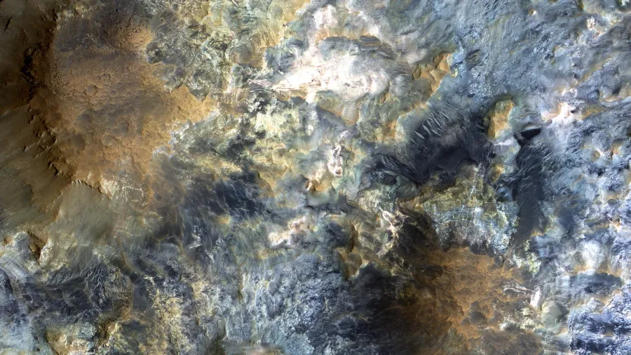
 Figure 3: High-resolution orbital imagery from the Mars Reconnaissance Orbiter revealing sinuous channels and sediment terraces in Ares Vallis.
The planetary mega-drainage hypothesis
Recent geomorphological mapping suggests that Ares Vallis belonged to an even larger integrated drainage network. Researchers have proposed the Uzboi-Ladon-Morava system, arguing that an unbroken sequence of channels linked Argyre Crater in the southern hemisphere all the way to Chryse Planitia in the north. If this planetary drainage hypothesis proves accurate, the total flow path extended over eight thousand kilometers, creating the longest continuous fluvial network known anywhere in the solar system.
Ares Vallis remains a primary target for astrobiology and planetary science. The presence of sedimentary terraces, clay minerals, and protected canyon walls offers an enduring record of an era when atmospheric pressures and local temperatures allowed liquid water to sculpt an entire hemisphere. Each layered deposit exposed along its dry cliffs preserves clues to how a dynamic, water-carved world transitioned into the frozen desert observed today.